Trail Location: Mekeldin access – 11676 Marriottsville Road
Marriottsville MD 21104
Trail Length:
Counties: Carroll, Montgomery
Trail Surface(s):
Trail Description:
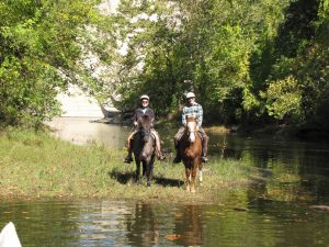
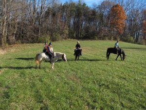
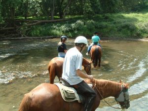
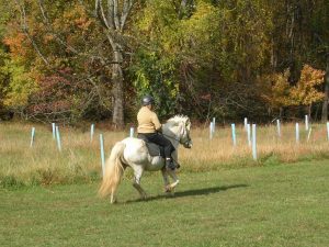
Avalon-Glen Artney-Orange Grove – This area offers hiking, picnicking, mountain biking, canoeing, bicycling, tubing, rental pavilions, fishing, equestrian trails, ball fields and playgrounds.
The Orange Grove Scenic Area has a two mile drive along the Patapsco to the Swinging Bridge. A fish passage has been installed at Bloedes Dam. This area is known for several historical sites – the Baltimore and Ohio Railroad, the Thomas Viaduct, remains of the Orange Grove Mill, Avalon
Iron and Nail Works and Bloedes Dam. The Avalon Visitor Center houses exhibits detailing 300 years of Patapsco history.
Avalon/Glen Artney/Orange Grove/Lost Lake Areas – From the Beltway (I-695) Take Rt. 1 (Exit 12-A) toward Elkridge.
Follow Rt. 1 South about 3 miles to South St. Turn right. Park entrance is on the left.
From I -95 take I-195 to Rt. 1 (Exit 3) toward Elkridge to South St. Turn right. Park entrance is on the left.
From Howard County follow Rt. 1 through Elkridge and into Baltimore County. Turn left onto South St. Park entrance is on
the left.
McKeldin Area – This area offers youth group camping, picnicking, rental pavilions, playgrounds, fishing, ball fields, hiking,
mountain biking, equestrian trails and a disc golf course. Hunting is available in designated areas by permit only. Hike,
bike or horseback ride scenic valley trails.
Parking and Trail Access: Park on grass next to basketball courts.
Seasonal Restrictions:
Reviews and Tips: Bathrooms and water.
Amenities: